Wednesday, 25th March, 2009: -
Well - Ms. May is home in Stuart, from her trip to the "Cold, Frozen,
North" (Toronto area) to visit her brother & his family... So, to
celebrate her coming home, we did the typical March in Stuart thing and
went boardsailing. The Wind was not the best in the world, but
we had FUN - which is the key component here.
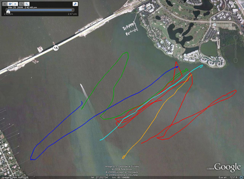
Here's a small 'bit' of a track-log with various 'tracks' in different colors... This was done using the OLD GPS (11 years old technology) and it doesn't do real well in terms of keeping up with the satellites while bouncing around at 25 mph on the sailboard. In a little under 2 hours on the water this thing ended-up with 11 different track-logs, only 5 of them were really 'relevant' and are shown here... The GPS was on Mr._Bill's board, but Ms._Huggly definitely is just as fast - if not, sometimes, a bit faster - she even beat me back to the beach today! if you want the ultra-huge (1.2 megabytes / 17" across (on most computer screens)) version click here.
AND in preparation for her coming home - I did yeoman's work in the yard yesterday and left this arrangement (16 trash-cans the most I've ever done) for the yard-trash-guy who came this morning...
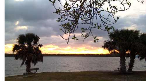
AND (yes - this is the last thing for today) - the iPhone3g continues to be both and amazing 'device' (with all it's gadgets and gehickles (and software applications)) but one of the best things about it is it's camera... It definitely has no flash and no zoom, but if one is PATIENT, one can take some moderately good pictures... - Here's a sunrise picture taken at the end of Cove Road, and the "Great Pocket" part of the Intracoastal Waterway. (this location is about 3-4 minutes from our house and it is one of the places we sometimes will go kayaking... (and you'll notice a sunSET in the picture just below here - both taken (with a little patience) with the iPhone3g's camera...
Monday, 16th March, 2009: - a VERY FULL DAY, today...
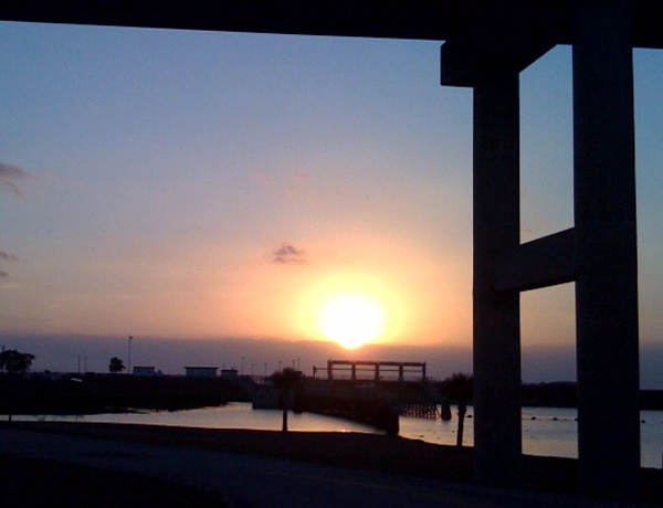
the above picture is 'under the bridge' at Port Mayaca, - where I sometimes ride the L.O.S.T., but this time I rode considerably south of here... but where we always have to 'pass through' to go Hang Gliding at "The Florida Ridge".
First I did a bit of Hang-Gliding (a great 'first' flight (the last two were nothing to 'write home about')) but the first one was right at an hour and it was excellent with seven climbs / thermals - all good - tracklog / data-file here and here's a link to a VERY BRIEF (90 second) iMovie ...
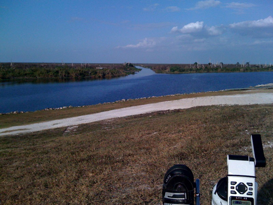
On the way home from Hang Gliding, I stopped at "South Bay" - a place along the very south-shore of Lake Okeechobee and got "L.O.S.T." - ( Lake Okeechobee Scenice Trail ) and pedalled the I.C.E. TriceQ (recumbent tricycle) about 25.6 miles, in just shy of two hours - so a very good 'pace' - I normally can set a pretty good pace on the "L.O.S.T." because there are no intersections, cars, police, traffic-lights, dogs, people jogging, iPods, etc.. That (partial) track-log is here. Also you can see, here, the blog-site for a 35 year old French lady who is crossing the Himalayas on a TriceQ very much like mine...
This sort of escapade makes me feel old, out-of-shape, and wimpy. I can not even begin to imagine how COLD it must be up there - and she talks about how to ride a trike that needs 'toe-clips' in 'snow-boots' (with no toe-clips) because it's hard to keep her feet warm - WOW do I feel like a wimp, today, when the temperature is near 65 F...
Wednesday, 11th March, 2009:
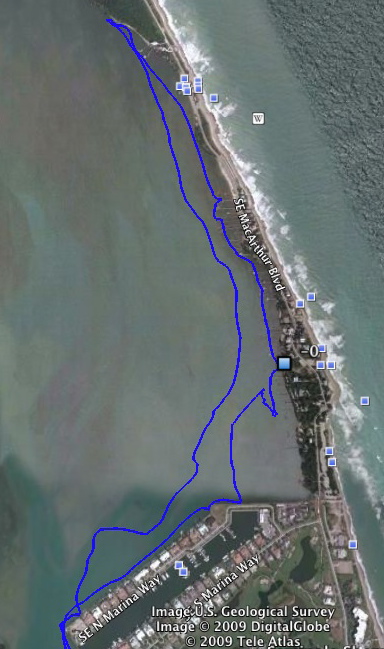
Today we did a short kayak trip with Mr._Alex, the brother-in-law (track-log on Google-Earth above).
We found a section of dredge-pipe that was alternately floating up to the surface and then sinking (to the bottom (which is probably less than 10 feet deep) - (we're guessing whether it floats or sinks) is depending on if there was air in the pipe and/or sand and/or whatever? - but the fact that it was coming up and going down was news to the guys running the dredge, so we HOPE they will do something about it...



Sunday, 8 March, 2009: - Today there wasn't much wind (well at 08:00 a.m. there wasn't much ( so I went for a Trike-Ride )) which lasted nearly 4 hours (actually a bit over 3 1/2 hours) and I rode 43.8 miles and WOW - anyone got any spare knees for me to beg, borrow, or steal?
This makes, now, well over 1,100 miles on my terrific Christmas present from my Mom: (pictured with our favourite naviguesser, Mr. Panda ( larger image here )). The I.C.E. TriceQ web-page is here.
There's a 'bit' of a track-log (of the TriceQ ride) overlaid on top of a Google Earth image here - but not all of the ride - I mis-calculated at the length of the ride (thought more like 30 miles instead of 43) and so there's not an entire track-log... - but - well ...
AND - this represents the end of another week wherein we attempted to entertain the part(s) of Ms._May's family that are here.
The_Stuart_Aerial_Circus continues it's meetings, and attempts to get other people than the instructor to soar like a bird (in the updraft in front of this abandoned beach-side hotel) in either a Hang Glider or a Para Glider - so - far not much succsess at instruction, but the student needs a 'perfect' day of wind strength and direction to practice. Finding those 'perfect' days is 'hit-or-miss' - but we continue to hope and pray...
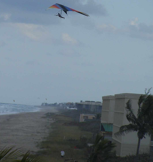
Here's another 'view' of Mr._Jeff_our_illustrious_instructor doing his Hang_Gliding thang in the air...
for a REALLY HUGE version of this image, click here... (also note kiteboard kites in the background (distance) and that's Mr._Ned_ in the bottom in the white tee-shirt)
(I also guess we should give credit to the EXPERTS in video that contract with certain municipalities that supplied this and two other AWESOME-huge Hi-Resolution images from an 'elevation' nearby...)
Sunday, 1 March, 2009: Today the wind blew a solid 20 to 35 mph - first out of the south-west, then out of the northwest (and the temperature dropped a good 10 degrees and it got cloudy... - so CHILLINESS was in the air. On the other hand it was an AWESOME great day drag-racing with a 4.5 square meter sail (I needed a 4.0 meter sail but didn't have one) - but - anyway - it was still a terrific day boardsailing at the 'East_Island' one of our favourite hang-outs...
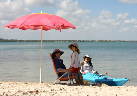
Ms._May's family (or most of them) are 'around and about'... (the above picture is a 28 February picture) We've spent a couple of days 'beach-going' (above image, taken by Ms._May's Dad is of her Mom and her Nephew Jacob, and Mr._Bill in his kayak...) - and kite flying and sightseeing and boat-riding, and kayaking and a number of other things... More pictures and text on Ms._May's_Blogspot_site: http://sailormay.blogspot.com
They brought the DVD version of the movie 'Wall-E' - which we desperately loved when we got it from Netflix, and it's STILL a VERY GOOD MOVIE - excellent story and amazing animation... - get INVOLVED with the love-afair between W.A.L.L. version "E" and the E.V.E. version "A"... - AMAZING stuff... On the other hand - seeing it 10 times in 3 days may be a little 'overload'...
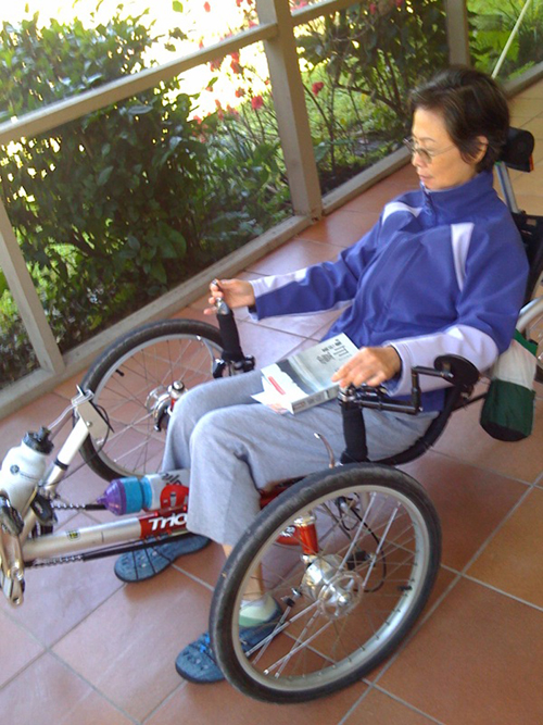
Ms._Amy (Ms._May's Mom) decided to try-out Mr._Bill's recumbent tricycle. Here she is getting the feel for it on the porch - later she rode it around the yard a couple of different times...
A New ThAng: Mr._Bill has now discovered (for his_iPhone3G_) something called "MotionX GPS" (both 'free-lite' version and a pay-money-for (I think less than $5.00) - see their web-site) - available from these guys: http://www.motionx.com.
Pretty stunning GPS application - it not only takes track-logs and e-mails them to you (or any e-mail address) but also has tremendous 'on-screen-display' (and on th iPhone3G's tiny screen this is an ACCOMPLISHMENT...) - some 'practice' tracks - / brief (very brief) track-logs are here:
(track-log(s) should be up 'soonish' (by 2 or 3 March) - I have them - but they are on another computer - and because of limitations in our house I can't get to the other computer 'right now'...???
Mr. Bill's best hang-gliding-flight (Ever) - see the FlightLog.Org web-page, here...

Here's a small 'bit' of a track-log with various 'tracks' in different colors... This was done using the OLD GPS (11 years old technology) and it doesn't do real well in terms of keeping up with the satellites while bouncing around at 25 mph on the sailboard. In a little under 2 hours on the water this thing ended-up with 11 different track-logs, only 5 of them were really 'relevant' and are shown here... The GPS was on Mr._Bill's board, but Ms._Huggly definitely is just as fast - if not, sometimes, a bit faster - she even beat me back to the beach today! if you want the ultra-huge (1.2 megabytes / 17" across (on most computer screens)) version click here.
AND in preparation for her coming home - I did yeoman's work in the yard yesterday and left this arrangement (16 trash-cans the most I've ever done) for the yard-trash-guy who came this morning...

AND (yes - this is the last thing for today) - the iPhone3g continues to be both and amazing 'device' (with all it's gadgets and gehickles (and software applications)) but one of the best things about it is it's camera... It definitely has no flash and no zoom, but if one is PATIENT, one can take some moderately good pictures... - Here's a sunrise picture taken at the end of Cove Road, and the "Great Pocket" part of the Intracoastal Waterway. (this location is about 3-4 minutes from our house and it is one of the places we sometimes will go kayaking... (and you'll notice a sunSET in the picture just below here - both taken (with a little patience) with the iPhone3g's camera...
Monday, 16th March, 2009: - a VERY FULL DAY, today...

the above picture is 'under the bridge' at Port Mayaca, - where I sometimes ride the L.O.S.T., but this time I rode considerably south of here... but where we always have to 'pass through' to go Hang Gliding at "The Florida Ridge".
First I did a bit of Hang-Gliding (a great 'first' flight (the last two were nothing to 'write home about')) but the first one was right at an hour and it was excellent with seven climbs / thermals - all good - tracklog / data-file here and here's a link to a VERY BRIEF (90 second) iMovie ...

On the way home from Hang Gliding, I stopped at "South Bay" - a place along the very south-shore of Lake Okeechobee and got "L.O.S.T." - ( Lake Okeechobee Scenice Trail ) and pedalled the I.C.E. TriceQ (recumbent tricycle) about 25.6 miles, in just shy of two hours - so a very good 'pace' - I normally can set a pretty good pace on the "L.O.S.T." because there are no intersections, cars, police, traffic-lights, dogs, people jogging, iPods, etc.. That (partial) track-log is here. Also you can see, here, the blog-site for a 35 year old French lady who is crossing the Himalayas on a TriceQ very much like mine...
This sort of escapade makes me feel old, out-of-shape, and wimpy. I can not even begin to imagine how COLD it must be up there - and she talks about how to ride a trike that needs 'toe-clips' in 'snow-boots' (with no toe-clips) because it's hard to keep her feet warm - WOW do I feel like a wimp, today, when the temperature is near 65 F...
Wednesday, 11th March, 2009:

Today we did a short kayak trip with Mr._Alex, the brother-in-law (track-log on Google-Earth above).
We found a section of dredge-pipe that was alternately floating up to the surface and then sinking (to the bottom (which is probably less than 10 feet deep) - (we're guessing whether it floats or sinks) is depending on if there was air in the pipe and/or sand and/or whatever? - but the fact that it was coming up and going down was news to the guys running the dredge, so we HOPE they will do something about it...


Sunday, 8 March, 2009: - Today there wasn't much wind (well at 08:00 a.m. there wasn't much ( so I went for a Trike-Ride )) which lasted nearly 4 hours (actually a bit over 3 1/2 hours) and I rode 43.8 miles and WOW - anyone got any spare knees for me to beg, borrow, or steal?
This makes, now, well over 1,100 miles on my terrific Christmas present from my Mom: (pictured with our favourite naviguesser, Mr. Panda ( larger image here )). The I.C.E. TriceQ web-page is here.
There's a 'bit' of a track-log (of the TriceQ ride) overlaid on top of a Google Earth image here - but not all of the ride - I mis-calculated at the length of the ride (thought more like 30 miles instead of 43) and so there's not an entire track-log... - but - well ...
AND - this represents the end of another week wherein we attempted to entertain the part(s) of Ms._May's family that are here.
- Drove to Key West - spent one night in hotel and stopped by the cousin's restaurant near Ft. Lauderdale on the return (600 plus miles)
- Went to the "St. Lucie Inlet (State) Park" partially by boat (saw a BUNCH of bottle-nose-dolphins on the way to the Park), and did a long walk through the woods (on their 'boardwalk') and up and down the beach (with the Atlantic Ocean to the East!!!)
- Our 15 year old
Boston_Whaler_Jet_(115hp_OMC_TurboJet)_Boat alarmed us with it's
engine_temperature alarm; but Mr._Bill has now 'debugged' this problem
with the help of much information from the web
and determined, - well determined that the thing overheated, but the
cause(s) (and there were a few) have been resolved, and some parts
inquired about - but - we'll see if the parts
can be had for this 15 year old engine / jet package from a company
(OMC) that basically no longer exists? (OMC was bascially bought-out by
Bombardier (who made our 14 year old GTS SeaDoo "Personal WaterCraft"
that we also have...) - we have a knack for 'OLD' things?
- Took brother-in-law-Alex to the "L.O.S.T." for a short (8.2 mile) bicycle ride for him, 16.2 miles for Mr. Bill - it was WINDY so Ms._May did not ride
- Ms._May has acted as 'tour-guide' for short trips to hither and yon, and as Jacob_absorber to absorb excess energy, and such...
- Yesterday: - brother-in-law-Alex & May's_Dad_Mr._Albert have gone to the Florida Space_Coast for a visit and to glean some great knowledge, wisdom and etc.
- Today: - the pilgrimmage is to the Disney environment, just southwest of Orlando - we'll see how they do when they return...
- Turns out, too, that Ms._May and Mr._Bill have similar 'penchants' for Klondike (ice-cream) bars (see above picture) when they are offered 2 for the price of one at our local Publix super-market... The people at Publix are NOT DUMB - they put the display case and the prominent "2 for 1" sign right near the check-out - so we now have 2 dozen Kondike bars! - (which - after 43 miles on the Trice-Q are VERY YUMMY!!!!)
The_Stuart_Aerial_Circus continues it's meetings, and attempts to get other people than the instructor to soar like a bird (in the updraft in front of this abandoned beach-side hotel) in either a Hang Glider or a Para Glider - so - far not much succsess at instruction, but the student needs a 'perfect' day of wind strength and direction to practice. Finding those 'perfect' days is 'hit-or-miss' - but we continue to hope and pray...
- Mr._Bill (who is a member of the "Stuart_Aerial_Circus") advanced the 'art' of the 'beach-drag' this week in our weekly meeting / attempts at Paraglider ground-handling. His new club-name is "Drag Queen" (Notice, I'm not yet a "King" of beach-dragging - I have not, yet, advanced to that level...
- Fortunately no damage to paraglider nor body ensued, and the bottom-line was that with sand in every single crack, crook, cranny, and etc., (especially those body-parts with sun-block on them) when the hubby-arrived-home he was shunned by the (more than) intelligent wife, to the outside shower to clean-up?!
- Here's a picture of Mr._Bill's_sandy_face (with his instructor, Jeff, on the left).

Here's another 'view' of Mr._Jeff_our_illustrious_instructor doing his Hang_Gliding thang in the air...
for a REALLY HUGE version of this image, click here... (also note kiteboard kites in the background (distance) and that's Mr._Ned_ in the bottom in the white tee-shirt)
(I also guess we should give credit to the EXPERTS in video that contract with certain municipalities that supplied this and two other AWESOME-huge Hi-Resolution images from an 'elevation' nearby...)
Sunday, 1 March, 2009: Today the wind blew a solid 20 to 35 mph - first out of the south-west, then out of the northwest (and the temperature dropped a good 10 degrees and it got cloudy... - so CHILLINESS was in the air. On the other hand it was an AWESOME great day drag-racing with a 4.5 square meter sail (I needed a 4.0 meter sail but didn't have one) - but - anyway - it was still a terrific day boardsailing at the 'East_Island' one of our favourite hang-outs...

Ms._May's family (or most of them) are 'around and about'... (the above picture is a 28 February picture) We've spent a couple of days 'beach-going' (above image, taken by Ms._May's Dad is of her Mom and her Nephew Jacob, and Mr._Bill in his kayak...) - and kite flying and sightseeing and boat-riding, and kayaking and a number of other things... More pictures and text on Ms._May's_Blogspot_site: http://sailormay.blogspot.com
They brought the DVD version of the movie 'Wall-E' - which we desperately loved when we got it from Netflix, and it's STILL a VERY GOOD MOVIE - excellent story and amazing animation... - get INVOLVED with the love-afair between W.A.L.L. version "E" and the E.V.E. version "A"... - AMAZING stuff... On the other hand - seeing it 10 times in 3 days may be a little 'overload'...

Ms._Amy (Ms._May's Mom) decided to try-out Mr._Bill's recumbent tricycle. Here she is getting the feel for it on the porch - later she rode it around the yard a couple of different times...
A New ThAng: Mr._Bill has now discovered (for his_iPhone3G_) something called "MotionX GPS" (both 'free-lite' version and a pay-money-for (I think less than $5.00) - see their web-site) - available from these guys: http://www.motionx.com.
Pretty stunning GPS application - it not only takes track-logs and e-mails them to you (or any e-mail address) but also has tremendous 'on-screen-display' (and on th iPhone3G's tiny screen this is an ACCOMPLISHMENT...) - some 'practice' tracks - / brief (very brief) track-logs are here:
- Brief Track-log 1 - (compiled Google Earth format (you need Google Earth on YOUR computer to click on this))... this is a VERY brief one while riding the Trice Q along the Lake_Okeechobee_Scenic_Trail ("_L.O.S.T._")
- Brief Track-log 2 - (compiled Google Earth format (you need Google Earth on YOUR computer to click on this))... this is a LONGER track-log along the "_L.O.S.T._"
- Brief Track-log 3 - (compiled Google Earth format (you need Google Earth on YOUR computer to click on this))...(this one is in the car from our home to our 'kite-park' (a ...kmz file
- This is a ...jpg IMAGE file of the above Brief Track-log 3 image-file
(track-log(s) should be up 'soonish' (by 2 or 3 March) - I have them - but they are on another computer - and because of limitations in our house I can't get to the other computer 'right now'...???
Mr. Bill's best hang-gliding-flight (Ever) - see the FlightLog.Org web-page, here...
and-or see the track-log over Google Earth Image(s), here... small_image larger_image (1 megabyte)
Archived BeachWeb monthly site(s): Click here for a list of the archived months
Some people have asked, WHERE can I FIND, "X" - whatever the heck "X" is?; but in my case - these two things are being asked about...
The "Tire Changing Web-Page" and/or the VANC (VikingAsia (Networks and Computers) Consulting) web-page.
AND / OR if you 'WANT' (or desire or need or have an 'urge' for something you don't see, then you can e-mail me at: bill@vikingasia.org
updated: 17:45 p.m. on Wednesday 25 March, 2009 - revID: 1n