Bill Schell's "BeachWeb" for July 2011 
Well - we are now WELL 'on-the-way' for our "Tour de America" - (the
"Tour de France" cycling event started Saturday, 2 July)
A few more days have now gone by! ...
We managed a brief (but sometimes wet (for Mr. Bill (who turned-over in
a rapids-area), but not necessarily for Ms. May)) kayaking-trip in
something called 'Inflatable Kayaks' - referred to by the 'hard-shell'
(kayak) crowd as 'duckies'... Link to 'Aire' site - similar to what we used, but not exactly the same model... We managed to get them through this company...
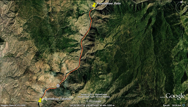
Anyway - this was 8 miles where sometimes you wonder what all the fuss
is about (you're bored to tears) and sometimes terrified of the
white-water... When asking 'what line to take through a rapid' -
someone responds with "Whitewater" - but after 60 years of thinking
white-water was dangerous (to boats and people) - it took me a while.
On the other hand, they don't call this 'White Water Kayaking'
for nothing?
The above 'route-line' was drawn on a Google-Earth image.
I did NOT take my good GPS since I did not want to risk
drowning or losing it (even though it is NOT behaving itself these
days). The city of Boise, Idaho is just about 80-100 miles
almost due-south of the take-out point at the bottom-left of the
image...
something a litle different: click on this link video-'taped' at this park.
=========================================================================================
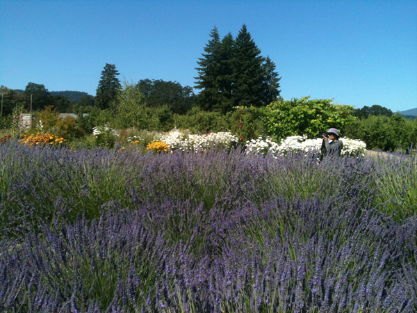
an opportunity we never thought about... - this place is called
"Hood River Lavender" and they grow a number of different species of
the plant, and process some of it into oils. We learned a LOT
about "Lavender" and it's varients and products and such from the
young-lady tending this 'demonstration' (my term, not theirs) plot of
land upon which several species grow...
I knew my 'pick-a-winner' cycling-trail great-trails luck could NOT
continue much longer - and this was about the ONLY THING OF NOTE to
find when we went north of Ontario, Oregon, to find a place to ride...
I will NOT divulge the name or anything OTHER THAN TO SAY - they
claimed 84 miles - with 'some' asphalt - bottom-line - asphalt was
barely 1 mile - and asphalt is about the only surface we can ride with
our tires...
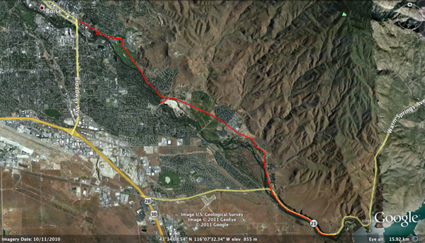
This was our ride in Boise, Idaho...
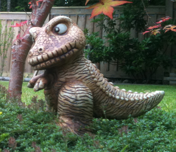
and before we left the cold-frozen-north - we found this creature in the back-yard one morning...
We're off to driving-back to hot-sunny-Florida, but had a few stops to make along the way...
One of these was Hood River, Oregon, on the Columbia River (which
separates Oregon from Washington for quite a while... We spent the
night in Hood River and got up and had an excellent, if short cycling
journey along an old part of US 30 between Hood River and Mosier,
Oregon. (no track-log on Google-Earth because the Google-Earth
image at this point is very funky (white-patina over the whole
geographic area)... - sorry -
==================================================================================================
This driving cross-country thing has taught me some things - and it has
re-acquainted my mind with some other things I thought I'd share:
1.) America 'feeds the world' because we have a HUGEMONGOUS amount of LAND that is useful for no - other - purpose than to grow food...
And a follow-on from that precept is that we have some seed companies
and other interests (MANY other interests) in the farming business
(and it IS A BUSINESS) that make our farmers WAY MORE EFFICIENT (in
terms of how much 'food' they produce per acre of farmed land).
(and that includes a LOT of 'things' in the efficiency equation)
2.) in Many MANY places in eastern Washington State, and eastern
Oregon, there is wheat and other crops, cultivated, LITERALLY AS FAR AS
THE EYE CAN SEE (and yeah - I know - what we SEE from an Interstate
(and/or other highway(s)) is NOT a LOT - but we know there is MORE OUT
THERE (sometimes compliments of Google Earth) and when you figure you
drive 2-4-6-8 hours and as far as the eye can see is a LONG WAY - that
means there's a LOT of crops out there - at harvest time that goes a
LONG WAY in feeding A LOT OF PEOPLE!
3.) We (as Americans) have the "interstate highway system" - that was
basically created - MANY years ago to prevent our failure in a war, it
has benefitted one and many over the years. It has no equal on
any other continent, in any other nation - and that gives one 'pause'
to consider the money and the thought and the planning that went into
this system!
4.) Ms. May and I have ridden our cycles, now - a bit over 400 miles during our bit - over 5,000 miles of car-travel.
In that roughly 400 miles of cycling we have seen some of the
best of the trails in the USA, no question. Today's trail, was
even better - at one of the many places where cars are not allowed, and
the surface and the view were beyond par.
We did a bit ove 9 miles betwen Hood River and Mosier, Oregon, along
the Columbia River, on the old US-30 highway that now runs on the same
piece of pavement as the Interstate 84...
We have managed, through extensive web-research, to find
some EXCELLENT trails, and I'm sure there are others - but the ones
we've chosen - we've been exceedingly lucky and fortunate, to have
picked some of the best.
AND Yeah ! - with the kind of track-record we have for 'picking winners' - we know that our luck can't hold-out...
5.) Hotels and Motels have offered up an amazing variety of services,
room-sizes and complimentary this and that - but the bottom-line (We
THINK!) we have discovered on / with hotels (and we've certainly done
our share of the low-mid-priced hotel thing), is that what really helps
in the hotel world is:
a.) quiet
b.) DECENT Wireless access (NO Hotel chain, (so far) has
anything close to DECENT (reliable, fast, predictable, etc. etc. etc.))
c.) GOOD (free) BREAKFAST - variety, freshness, fruit, etc.
d.) proximity to the Interstate
e.) parking-proximity to the point-of-entry...
f.) your ability as a 'patron' / 'customer' to get these things
(or a 'reasonable-trade-off' on them - is related DIRECTLY to price...
- the $40 a night hotels are considerably lower in most features /
functions than the $80 a night hotels. - Not a surprise, really, but
something that has 'hit-home' on more than one stay...
===========================================================================================================
Day 26 - (Monday, 25 July): - we're getting close to a 'month away' - bottom-line, not far (days wise) from home!
- just so you know - the (weather) forecasters in Canada are NO BETTER than the forecasters in the USA.
- Today was supposed to be warm and sunny - but during a late morning
ride - not ONLY did we go from about 5% cloud cover to over 100%
cloud-cover - the temperature dropped about 10 degrees C - and I was
nearly frozen (and WET) when I finished my very short ride...
- Now back in Port Moody for lunch and it's still over 100% cloud-cover and it's BLOWING out there.... -
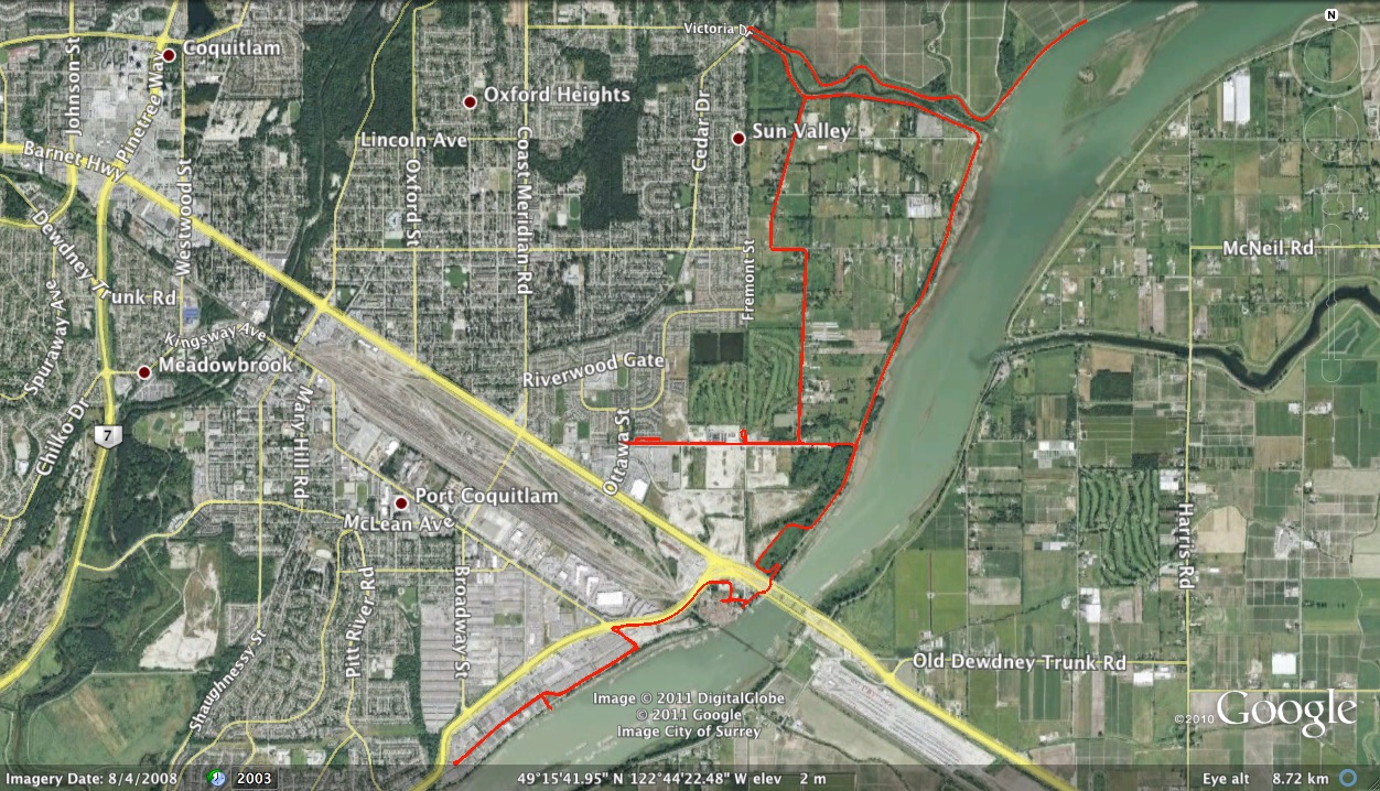
this morning's ride was ALL ON THE FLAT except crossing the
Pitt-River-Bridge (two spikes in the early part of the 'Profile'
( small file / large file )
and/or the track-log-file on-top-of Google Earth Imagery... ( small file / large file )
Day 25 - (Sunday, 24 July): - a number of other 'observations' about etc. etc. etc.
When someone in the family plays Facebook "Backyard Monsters" (a
computer-game) and they go away for a while; it is up to the remaining
family members to 'feed' the on-line-pets (Monsters). Believe it
or not - with a number college degrees between us (Ms. May and
myself) and a LOT of computer experience this was NOT a
'Slam-Dunk'.
We REALLY HAD TO WORK to figure this out - and though the
computer-monsters have not, Yet (that we know of) died, we're still a
bit on 'pins and needles' til the real expert(s) return and make sure
we did this correctly.
SO do NOT make the 'Assumption' that if you know about computers, you know about 'computer-games' - because you probably do not!
some other observation(s):
- Canadians are - by and large VERY AWARE of cyclists and VERY pleasant to meet at road-crossings
- Canadians MUST LIKE LARGE, WET, MUDDY dogs because there sure were a LOT of them (dogs) on the scenic levies yesterday.
- Though LARGE WET DIRTY DOGS was NOT what make the levies scenic, I can assure you...
- Canadians are - by and large very 'nationalistic' - they
LIKE their country and they LIKE that it can be considered a COUNTRY in
it's own right and they would LIKE to not have a HUGE
International powerhouse right next door, but to some extent - sharing
a border with the USA is a double-edged sword - and I'll leave it to
others to bring-out the details there...
- The "Scenery" around here is excellent - you can not help
but notice the clear-blue-skies (which are, apparently, rare) and the
mountain-views and the rivers, and the snow-caps, and etc. etc. etc. -
it's really a very very scenic place to be / spend time / realize we
are in an area of scenic beauty (when we go out cycling you really
(REALLY) notice the views) - We've been coming here for the better part
of 16 years but it took this trip - where we went cycling a LOT
(and had EXCELLENT WEATHER some-times to recognize the inherent
beauty of the area.
- we are A LONG DAMNED WAY from 'home' (Stuart-Florida) and
we'll get back there 'eventually' but - we have recognized several
things:
- America is a HUGE (HUGE) country on a HUGE HUGE continent...
- Driving is the ONLY way to see places most people never do get to see and we've seen a LOT of those small-places.
- Driving takes a commitment (of time AND
dollars) and that's something that most people don't have, the
time and the dollars - we were lucky!
- Driving takes 'some-planning' - but also some flexibility to 'alter' one's plan(s)
- Driving takes 'some compromise' (like we would LIKE to have brought "All our Toys" but the mini-van is limited in it's capacity)
- Driving takes WAY MORE patience than one would like to admit before getting involved in this sort of 4,500 mile commitment
- Do NOT OVER-estimate your ability to drive from point A to
point B in a given day - you may discover something between A & B
that warrants further investigation
- WE HAVE ENJOYED (greatly) the cycling intervals - and it
is a TERRIFIC addition to a cross-country-(driving) trip to be able to
have the luxury to stop and get some REAL exercise periodically... The
exercise makes the driving go much much better.
- Having friends along the way is wonderful - BUT - do not
fail to recognize other people 'have a life', they are NOT going to
'wait-around' for your schedule - so - again - be FLEXIBLE...
==================================================================================
Day 24 - (Saturday, 23 July): - well - the weather has 'broken' - and we know this because:
at least half of Vancouver & environs are at "Pitt Lake" - judging
by the amount of cars / boat-trailers / skin that looks like it just
crawled out from under a rock and hasn't seen the sun in 5 years:
- the temperature is OVER 85 F (and Ms. May's parent's house
has NO 'Forced Air' system to keep it cool (even without
air-conditioning))
- the SUN is out ALL DAY - and there are only a very very very few TINY clouds in the air
- And we think the half of Vancouver that is NOT at Pitt Lake
is riding their bicycles, walking their dogs, walking themselves or
doing something else, OUTSIDE, on this monumentally beautiful day
that does not often take place in the Vancouver-Land area... (on the
other hand, in Stuart, this is a 'normal' day...
So - today MIGHT be a day for reflection on the status of life,
liberty, the pursuit of happiness (and riding cycles) in and around the
(eastern-most Municipalities) of the Vancouver area:
- People who drive cars here are VERY NICE to cyclists at road-crossing(s)
- BIG road-crossings have these 'chirpers' that you do NOT have to wait until your hair turns grey to get them to change the light
- Driveways and intersections are like they are in ANY Municipality - you
have to STAY ALERT and WATCHFUL! (even with nice people driving cars)
- DOWN-HILL (fast) on sidewalks yields a 'bumpty-bumpty-bumpty' that
is 'most unpleasant' at anything over about 8 mph - but the down-hilll
slopes want you to do about 28 mph...
- UP-HILL (slow) on sidewalks is NOT a problem (because you're going SO SLOW that the bumpty-bumpty doesn't make a difference)
- UP-HILL (slow) on a trike - even at 1.5 mph is NOT a
(balance) problem whereas the same speed, UP-HILL on an upright means
you're probably NOT upright any more?
- 99.9% of ALLLLLL the "Levy-Top-Trails" are this tiny gravel
(about 3/8" / 10mm screen-opening-size) over hard-packed-lime-base and
that is not 'that-bad' - per-se, but the problem is with 110 psi
street-racing-tires is the vibration and the noise are monumental.
I am of the FIRM BELIEF that both Ms. May's
carbon-framed-Trek-up-right and my Trike, could use lower-pressure -
wider - softer - knobbier tires and we would be MUCH HAPPIER.
'Next Time' ...
- We probably have enough (spare) tires back in
Florida to do this - I just didn't think about it ?
- The "Levy-Top-Trails" are exceedingly scenic in this flat-land /
flood-plain, plus mountains-in-the-distance area. You can't get
any more scenic than these Levy-Top-Trails - they are pretty
spectacular... (but they are all gravel!)
- when it's OVERCAST out - almost no matter what the temperature, I
GET COLD (and when going DOWN-HILL (fast) one gets even COLDER - on the
other hand - UP-HILL is slow and hard-work, and HOT - so - how do you
'balance' all that - I don't know - tell me when you find out!
- Some of the best bike-paths / bike-lanes are not necessarily OBVIOUS until you're riding on them
- The BEST thing to do - assuming you have the time, energy, money,
etc. is to 'Pre-Drive' (in a car) the route that you think you want to
take - it REALLY makes for some nice route-planning to drive them
first...!!!
- The SECOND BEST is to spend time "on-line" (and I do mean a LOT
of TIME - like for every hour you ride, you probably need to spend at
least one hour on-line - perusing the web-site(s) (those listed below
are only three of the "BIG" ones. The other place to look is to
'search-for' (Google or other Search Engines) cycling and
"some-city-name".
There are at least 3 different Internet-based / web-sites that
have trail information (all are "not-for-profit", though, so you can
easily donate to them if you like):
- This one I liked 'best', it was, "BikeMap": (headquarters and programmers mostly German) http://www.bikemap.net
- One that is very USA-focused on "Rails to Trails" is 'here'
- I liked this one least, BUT it had more 'I did this, it was good'
information from individuals, and less about 'organized' (posted /
public) trails was, one called "Map My Ride" (also has sections for
walking, hiking, etc.) http://www.mapmyride.com
Today's ride (east side of Pitt River - also at Pitt-Lake) - the
'town-name' to search for might be "Pitt Meadows" (B.C. CANADA)
it is the flood-plain a bit NW of the actual 'town'
(more a village by most definitions). Most of the area is
farmland and the views to the north are of the mountains and it's
pretty spectacular...
ride-elevation-profile: ( small file / large file
) <=== these 'profiles' do not show a lot - since 99% of this
route was within about 1-3 meters above Mean High Water (the global
standard for elevation / altitude). These profiles
are from Google Earth - and not from the generic ...gpx file(s) / via
"Flight-Track" (a Macintosh Only hang-gliding (aviation) software
gadget / tool that has not been updated in YEARS) that the below
profiles are from. Again - they don't 'mean' a lot...
However, the Google Earth methodology of collecting, processing and
displaying the profile is / are very good, actually much better than
some other tools.
Garmin - GPS-Track-Log-file (overlaid on top of Google Earth imagery): ( small file / large file )
===========================================================================================================
Day 23 - Friday, 22 July): LOTs
of things happening today - the weather (most (MOST) importantly) has
just begun to 'cooperate' - it warmed up a bit and the sun came out and
that's an improvement over the past few days - and the rains stopped...
Forecast for the next couple of weeks includes no rain at all -
(as opposed to the last couple of weeks) - where it has 'mostly'
rained...
This morning we managed quite a few tasks, - mostly cleaning-out the
mini-van (a major job) - cleaning UP the trike (I'd already cleaned-up
Ms. May's bike - but the trike, being closer to the ground seems to get
dirtier - and yesterday I did probably 12-15 miles on gravel; so that
made the trike even dirtier...
AND - after lunch I changed the back tire and then had a good ride,
went South and East to the parking-lot where I parked for yesterday's
ride. Then I came back here (which was about 90% up-hill)...
Profile: ( small file / large file )
Track-Log-file (overlaid on top of Google Earth imagery): ( small file / large file )
Ms. Yee, Mr. Alex, and their son Mr. Jacob have gone to a camp (where
there are children and adult activities; nearby, for a couple of
evenings. So we are basically a smaller family-unit for a couple
of days...
Other activities in / around / over / under / etc. etc. etc...
There's been a BIG Car-Fire here in BC; the taxing-authorities
here are fighting (as always); the world at large is still out
there (in case we'd forgotten); Florida is NOT part of the US-National
HEAT WAVE (apparently), and - in general life-goes-on-without-us - (no
surprise there!),
WE EVEN have to 'feed' the (computer-game) monsters at certain
times (of the day and night) when certain people are away...
I WONDER if we didn't feed them on-time would they die (and what would be the consequences)
- would they rot inside the computer and would the computer then, smell like dead monsters?
AND - AND - we've been 'invited' to 'participate' in a 'basic' (it will
have to be for the likes of us!) introduction to white-water kayaking
with a friend north of Boise, Idaho... - that should be VERY
interesting - can you understand WET, ROCKS, Kayaks, and other such
things in our lives - - but - well - one of the (VERY FEW) water-sports
we haven't tried yet.
AND other people we were going to see hither, yon, and yonder, are
either out-of-town, or getting-married, or riding their bicycles up to
a racing-finish-line at 14,000 feet (geezus - I didn't even know they
made land at that elevation!)... Anyway - we're
semi-planning to get back to Florida SOME TIME - but who knows when,
and the house and the hurricanes are both in good hands - at least we
keep seeing the hurricanes pointing AWAY from south-Florida so someone
is doing SOME-THING right (it may not be us, though...)...
AND - what else - OH - The people here around are VERY NICE when you're
cycling and want to cross a road - people in Florida would NEVER let
you cross the road (the number of people getting KILLED in Florida
cycling is phenomenal)... But in some cities we cycled in - in the USA
and here in Vancouver, auto-mobile drivers are MUCH NICER...!!!
AND - we got NEW (And EXCITING) wiper-blade-refills - so just in case it rains on us in the mini-van; we'll be able to see...
and - and - and - and - you get the picture?
==========================================================================================================
Day 22 - (Thursday, 21 July): rain this morning, brighter this afternoon (but only for a while)... - then it turned overcast and VERY COOLish
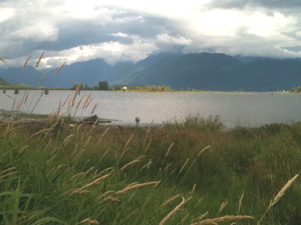
view of the "BEAUTIFUL Pitt River" (where I rode along the west-bank) looking almost north from the River Trail..

- had a short-ride - adrenaline kicked-in when I saw a
black-bear(cub) cross-my-path; never did see "Mom-bear" - but I suspect
she was nearby
- (Pitt) River is a NICE VIEW from a lot of places on the trail but some places the weeds are too high to see it..
- and they have made a good effort on the trail, but most of it
was tiny gravel over hard-packed-lime-rock and eventually I 'gave-up'
from the noise and vibration and came back to the car via tarmac (which
was WAAAAAAY Smoother - and silent and NO Traffic!
==================================================================================================
Day 21 - (Wednesday, 20 July): sorry - more RAIN in Vancouver...
We went to see"Kung Fu Panda 2"
- at an INDOOR (warm / dry) theatre. It were AWESOME - and the
voices by Jack Black, Angelina Jolie, Lucy Liu, Michelle Yeoh, Dennis
Haysbert, Jackie Chan, Seth Rogen, Dustin Hoffman, Gary Oldman (amongst
others) were EXCELLENT - all in all I believe this was a MUCH BETTER
movie than Kung Fu Panda 1 - but - hey I have been known to be wrong in
the past... - a couple of links: "IMDB.com" and "Wikipedia".
=====================================================================================================
Day 20 - (Tuesday, 19th July) - a very short (but hard) mid-day-ride - a bit before lunch and a longer bit after lunch:

Image of a cycling-ride-profile, with 'X-axis' denoted in miles.

Image of the very same-ride-profile, with 'X-axis' denoted in time (hours : minutes)
- from about 0:50 minutes until about 1:40 minutes I was eating lunch - that is why there is a horizontal line there...
yesterday's ride (on Tuesday, 19th) - I'm going to 'publish' two
'profiles' - and - yeah - one is actually BIGGER than the 'other' - but
what is really different is the horizontal scale, - one is in hours,
the other in miles (distance) - please tell me (by return e-mail)
- which is 'more useful' - or are they 'about the same'?
ALSO: you might want to visit this web-site: http://www.bikemap.net -
excellent site - created by some German guys who have ridden,
extensively, in the USA... very flexible and versatile, much more so
than other routing / trail web-sites we've used... and this one
even has a 'free' iPhone app - which I've downloaded and 'synched' via
cable with my iPhone - and when I turn-on the iPhone (again) when we
get back to the USA - then it will - at least theoretically, look at my
'current location' and I can 'select' in it's database-look-up screen -
that I want 'paved' trails - and it will show me (I HOPE) trails that
are nearby to my 'current location'...???
============================================================================
Day 19 - Monday 18th July):
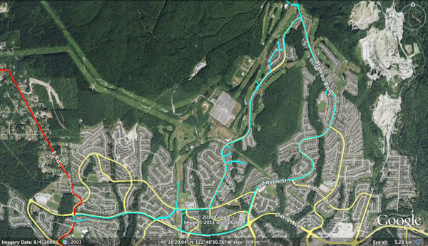
today's ride (in image above) is denoted in 'cyan' color;
yesterday's ride is still in red (in the image(s) both above and below)
- I managed "UP-HILL" today for nearly 45 minutes - something I was not
sure I could do - but I managed it - just below you'll find the
'profile' of today's ride... I also went considerably off the map
my sister-in-law, Ms. Yee, had given me so I was, to some extent
'winging-it' - which wasn't a bad deal at all. Met up with a guy
on a mountain bike and we 'raced' (downhill) until one of those
flashing signs said "You're going TOO DARNED FAST"... - I never reset
my GPS to km / hour.. - sorry...

Since it 'looks like rain' we may or may not get to ride, later
today... - We've been invited to visit central Idaho on our return trip
which will most probably start in about a week to 10 days from now -
'about' on the 28th or so of this month - we'll see. Our
"Original" plan was two weeks to drive out here, two weeks here, and
two weeks to drive back to Florida. We drove out here in about
12 days (instead of 14), so what comes next is still up-for-debate,
we'll see...
====================================================================================================
Day 18 - Sunday, 17th July):
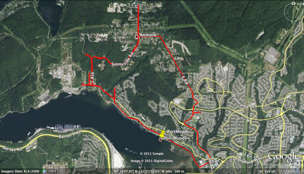

morning ride (short but hard) - profile & track-log-image just above
- only 14.3 miles long - about 2 hours, max downhill speed was something just above 39 mph.
The vertical was something to behold (see profile, above) - 20 minute
up-hills and 2-3 minute down-hills, the last-bit-of-up-hill was about
1.5 to
about 2.5 mph for about 15-20 minutes. Ms. May was riding with me for a part of this morning's ride...
I persevered a little longer. Then - maybe tomorrow (or sometime
next week when the rains have stopped) her sister, Ms. Yee, has
recommended a ride that will be equally 'Up-Hill' with some very
nice views we're told... - and about 8-10 miles long. - We'll see
(it's through residential areas) how much / many views versus the
up-hill / down-hill ratio...
============================================================================
Day 16 - (Friday, 15 July) - today Mr. Bill did more tricycling, while Ms. May entertained Jacob and others...
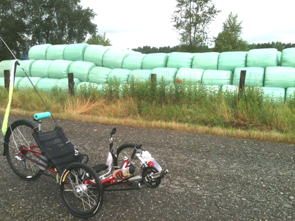
A 'brief' on the ride: - two different sites - Barnston Island
(above) - reputed to be excellent by someone on in-line-skates,
but after having been-there / done that (2 laps each of which was about
6.3 miles (and the surface of the road, though 'asphalt' was VERY
IFFY...)) - I would say I probably would NOT do this thing on
in-line-skates, though I guess some would - I knew my 'good-luck'would
not hold-out for long!
Border-Marker for border between USA and Canada
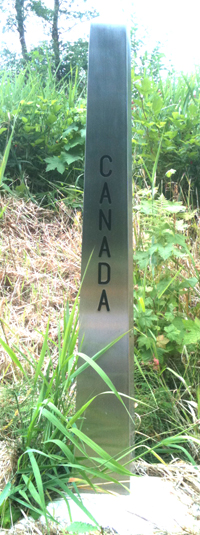
then - went to what the locals call 'Avenue 0 (Zero)' - what the
American's might call "The Border" - and what the GPS and
map-maker-types might call 49.00000000000000 degrees north... ANYWAY -
another (batch of HILLS!) - but - well - 43 mph down one of them meant
about 2.7 mph UP that same hill - but did about 21.5 miles around there
(due east and due-west) as one might imagine, it being the border
between the USA and Canada...
track-logs of these rides available "upon-request" - neither is a whole lot to write home about?
=================================================================
Day 15 - sorry - RAIN!!!! - we give up! - maybe do 'inside' things today...
=================================================================
(Day 14) - In VanCOLD, now - so cold here I had to throw-on a jacket after today's (very-short) ride to keep from getting chilled...
and YES - it RAINED yesterday (as we drove another 9 hours (after a 2
1/2 hour morning ride (in the RAIN) in Coeur d'Alene, Idaho.)
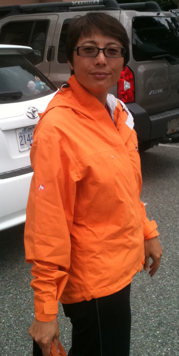
Ms. May sporting her new jacket...
as President Obama is famous for saying, 'Let me be entirely clear about this':
1.) regardless of where you 'route' yourself (based on Ms. Psycho
Betty's recommendation(s)) - it will RAIN on your NEW ROUTE when you
re-route yourself (against her best wishes...
2.) Ms. Psycho Betty has HER IDEA of what a 'good-route' is by criteria
that are, I'm certain ONLY CLEAR to Garmin's Nuvi's software people
3.) REGARDLESS of how good your car is, how fast, and how stable, the
point you are attempting to get to is ALWAYS at least one more hour
than you have the energy to drive
4.) if you drive west & north for 10 days you WILL end up with a
'burnt-to-a-crisp' left-arm, unless you wear a long-sleeved-shirt...
5.) ONE DAY you will feel like you've waited your ENTIRE LIFE for
'this-day; this activity and this 'piece of equipment' and you will
decide "This is what I was ultimately meant to do" _ I 'think' I had
that feeling when we rode around "Lake Coeur d'Alene" a few days ago...
6.) You have to learn to do some web-based research but when you SPEND
THE HOURS (and it will NOT take Minutes - it WILL TAKE HOURS) doing the
web-research. - you WILL ULTIMATELY pick some 'winners' in terms of
trails. I think we've now ridden 'about' 8, maybe 12 times on
this trip and it seems like (up until now) each trail has been better
and better and better. - BUT, what that says is that eventually I will
NOT pick a Winner - and I think that happened today... (Port Moody's
ride, though short, proved the theory that Urban trails are meant for
the dog-walkers and the walkers, and the commuters, but not for the
'riders'?
=============================================================================================
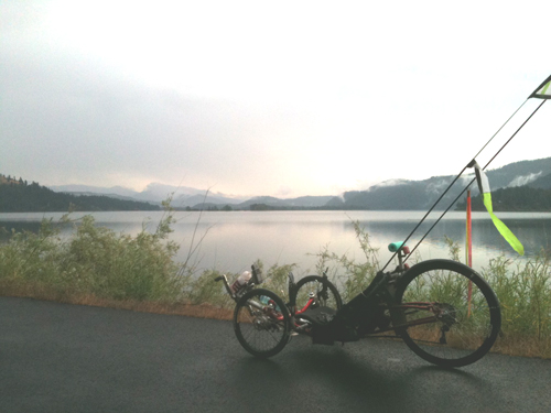
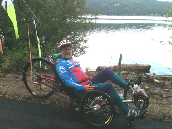
Lake Coeur d'Alene & the TriceQ - this was a long ride (over
30 miles, round-trip) on a trail that was something like 60 plus miles
overall, it had a GREAT DOWN-HILL at the start (which, of course, meant
a GREAT UP-HILL at the END (when we were tired) and the RAINs came in a
BIG WAY... - but - it was STILL probably the best ride we'd done so far
- we keep upping-the-ante - better and better rides all around...
here's the Missoula, Montana track-log
on a Google Earth satellite image - sorry, no pictures in Missoula...
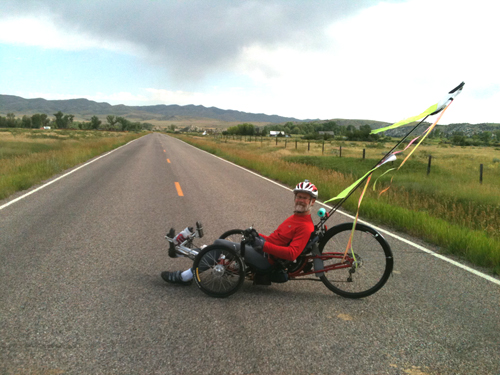
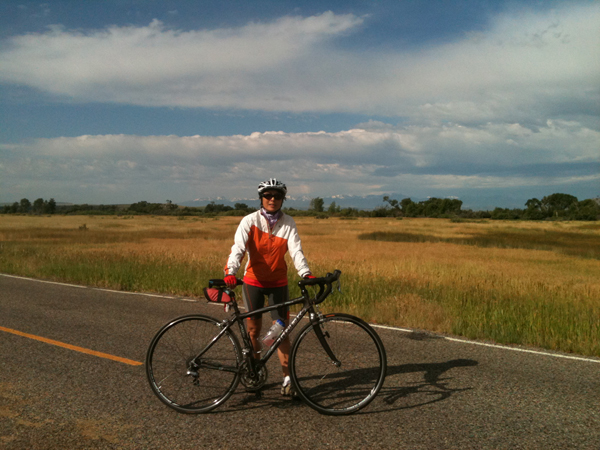
3 Forks, Montana... this was a good ride - if a bit short and a
tiny-bit-of-rain - we managed, well, though. The above pictures
were taken (as you might determine) in the middle of the road - a VERY
VERY Un-Travelled road we might add... - the track-log over a Google Earth Image is here...
Day 11, (Sunday, 10 July): - driving around seeing things in Yellowstone National Park (mostly in Wyoming)
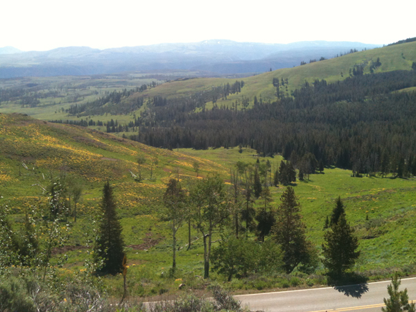
a BIG Valley we came across at something like 8,800 feet
elevation (I've been to about 8,500 feet hang-gliding - it's a LONG
DAMNED WAY UP THERE (especially when you launch your hang-glider near
'sea-level' as in Florida...!!!)
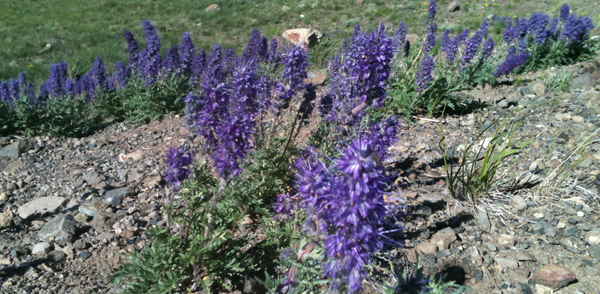
some random purple flowers
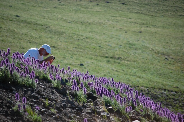
and - well - SOME times the photographer (of purple-flowers) gets his picture took, too!
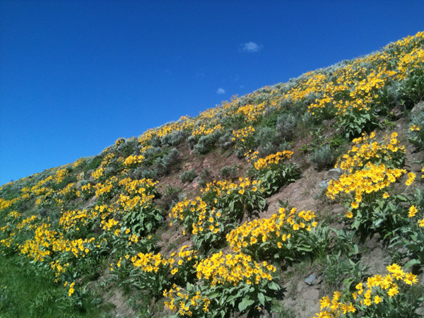
and a few more (yellow in case you're color-blind) flowers (picture by Ms. May while Mr. Bill was driving!)
this is a VERY SMALL picture of what used to cause an 'owie' on the dock at my parent's house about 20-30 years ago...
this is a bit LARGER picture of the same "owie"
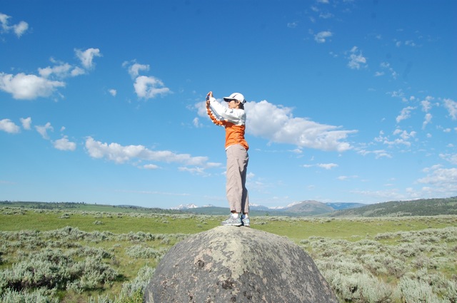
AND Some-Times Ms. May stands 'On Top of the World' (note the 'round-rock'?) -
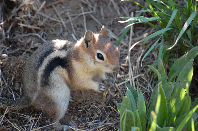
AND - last - but VERY NOT LEAST - Mr. Panda said we needed another
'animal-friend' and we ALWAYS listen to Mr. Panda's advice,
SOOOOOOoooooo we met up with this little-guy... We'd found some
of his friends, but they were not very photo-genic... - but we wasted a
lot of 'bits' (not film) on his friends..
This one was EXCELLENT
- photo by Ms. May and her Nikon and a GOOD-BIG-Lens and her quick aiming and shooting skills!
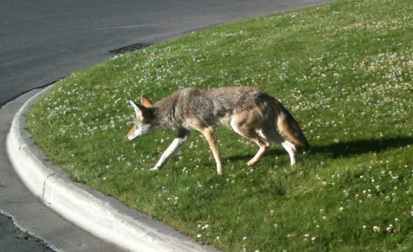
and - we met another animal-friend - who asked us for some breakfast -
but - unfortunately - we didn't have anything to give him...
===================================================================
Days 8, 9, 10 (Thursday - Saturday (7th, 8th, 9th July)) ---
well - on the 9th we spent time in YellowStone National Park - and what
a sight to see both going and coming we found various and sundry things
that you might be interested in:
A road-side 'rest-area' where the Yellowstone River flowed-by - not 'wildly' exciting but a 'flavour' of the environment
A 'standing-wave (rapid?)'
video in the Yellow-River (at considerably above flood-stage. (and yes
we picked-up some guy and gave him a car-ride back to his truck after
his raft flipped even before this point in the river...)
A "hot-spring" video
A "small" geyser video
An "Old Faithful" video ( long ) and ( short )
whoops - we did some other things, too - more pictures & text of these events 'to-come-at-a-later-date'...
Days 6 & 7 - (Tuesday-Wednesday (5th and 6th July)): -
not much else to report: get-up, pack the 'junk' in the room, eat
a minimal breakfast, ride cycle for a few hours, sweat, change clothes,
drive, eat, sleep, rinse, repeat...
Tuesday we rode at "Tunnel Hill State Park" (Illinois) - here's the 'track-log-overlaid on a Google Earth satellite photo' & here's the ...kml file.
This day we encountered 'some hills' (about 9 miles worth) at about 9.5
mph UP the hill (and Ms. May fell-over in the COMPLETELY DARK "Tunnel"
of "Tunnel-Hill"). Well the downhill was pretty awesome. Top
speed this day was about 25 mph. We rode 'about' 20 miles round
trip...
Wednesday we rode at "Raccoon River State Park" (Iowa (near Des Moines) actually we left & returned to a place called Redfield) and the 'track-log-overlaid on a Google Earth satellite photo' & here's the ...kml file,
too, in case you're interested... This ride was nearly 35 miles
in about 3 hours (moving-time), with 'some hills' (read this as 8-10
mph UP (for 4 miles or so) and 22-26 mph DOWN the same hill...
Max speed, this day was - I think - 27 mph
Not many pictures here - but it was a good couple of days riding and
driving... - one note on the drive, though - if you're going to do
Kansas City and/or Des Moines into the Minneapolis - St. Paul area -
MAKE SURE to have some FOOD and some GAS, because there 'ain't much of
either out there!!!....
MOST of the trails we've cycled upon are 'Rails to Trails' - there are
several web-sites that support this sort of trail. A couple of
things to note, though: - 1.) they are 'mostly' overgrown - which means
'mostly' in the shade. 2.) they are 'mostly' straight (at least
considering the speed of a cycle). 3.) they have very little
vertical variation. - I say there are 'hills' and there ARE,
(especially compared to Florida (which is FLAT (ever notice how the
word "Florida" and the word "Flat" both start with 'FL' ????)))
Day 5 (Monday, 4th July) - RAIN is the word for today (sometimes
in-compatible with fireworks, we're told)... - Anyway - got a short, if
TOUGH cycling episode in this morning BEFORE the rain, though one hill
- upon the return was "Slip Slip" (back tire) - on the wet-pavement at
about 2.0 mph (yeah that is REALLY SLOW!!!) - heck of a hill,
though!... Track-log on Google-Earth here and ...kml file here
Mr. John & Ms. Lily and Ms. May cooked some GOOD hot-dogs and other
such things on the grill, by the lake, until the rains came and when
they came they came with VENGENCE and AGGRESSION. We wandered
back to their place in the RAIN - and - well - you can guess the rest
(naps, inside, and internet-inside and other such things inside....
=======================================================================================
Day 4 (Sunday, 3 July): - well - we did a 'bit' of cycling this morning - track-log on Google Earth here
While at the local 'park' I found a group of Geese (or something) who
were VERY CUTE when they 'waddled' around and "talked", if you like
this sort of thing, click-here for a 7 second video and turn-up your sound...
- and I broke a flag-staff (which I managed to fix (but had to take
everything out of the back of the car to get to the tools...)
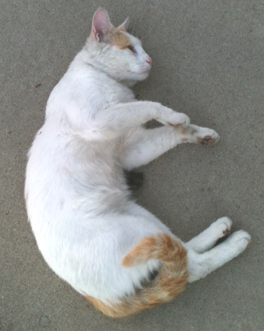
Ms. Town Greeter wanted something to eat from the Mini-Van - but - well
- we didn't have anything that she liked - so she wandered on and
begged from someone else, I guess...
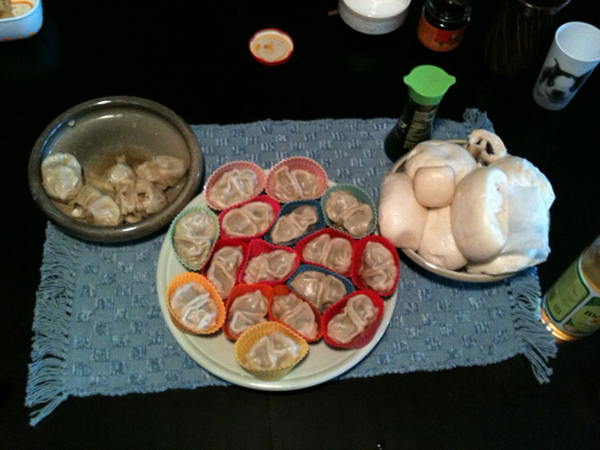
We had a good (very good) dinner this evening:
=================================================================================
Day 3 (Saturday 2 July) - we rode the first ever (time for us) on a
'down-town / metropolitan' bike-path - and it was pretty good - amazing
what a small town can do if they put their mind to it...
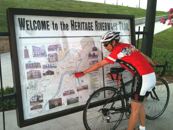
Here's a track-log-file on top of a Google-Earth image if you want to see where we rode (both blue and red lines are track-logs...).
HERE is the link for the 'Arches' - I 'guess' that these are supposed to represent the arches that supported the aqueducts in ancient Rome - Itlay?
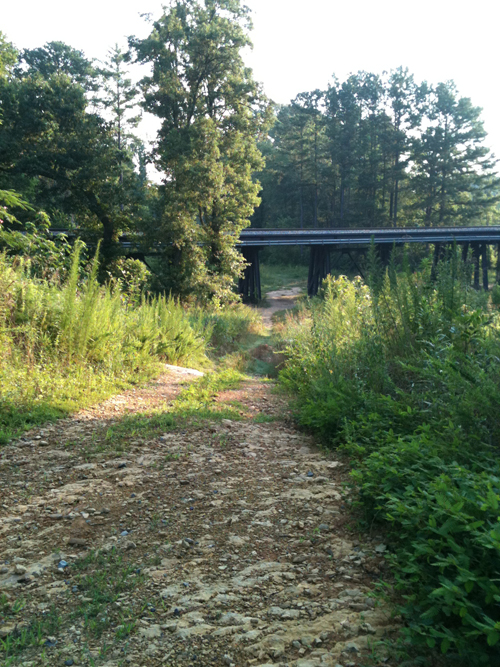
Mr. Bill lost Ms. May but found this (not really meant for road-cyclists (like us and our 'equipment'):
=================================================================================
a Day-2 Picture of Ms. May on Amelia Island...
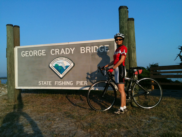
Day 2 (01 July - a Friday): - we drove (again (early)) to Amelia Island
(NE of Jacksonville, on the Florida Coast), and had an excellent if
short (14 mile) cycle ride and it was a GREAT THING to see the old oak
trees hanging-over the road, providing shade and see all the little
bays, inlets, and swamps that I had not visited for 30-40 years or so.
Then we had an excellent breakfast in Fernandina and
visited, very briefly, the Fort Clinch State Park,
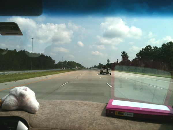
(this picture when we did NOT encounter Rain nor Traffic-Jams!!)
and eventually drove up into Georgia along I-95, I-16, and I-75 and
I-285 around Atlanta. However, we managed to find a LOT of RAIN
and even MORE traffic-jams (200 of 400 miles!), - I do NOT THINK we'll
use the Interstate system around Atlanta in the future...
We had dinner here and it were
EXCELLENT... <= The link is to their 'Facebook' page...
Their ribs were tender, the cornbread just exactly what it's
supposed to be and the fried-okra was divine... Too bad they don't do
business in Florida but it certainly made the "old southern-boy" proud
to see that someone REALLY DOES BBQ CORRECTLY.!!!
======================================================
Day 1 (30 June - a Thursday): - drove (early) up I-95 from Stuart to
Jacksonville. Then attended memorial service(s) for Bill's
recently deceased Uncle "Boink" (when I was a kid I couldn't pronounce
"Bronson" - so he became Uncle "BOINK")... - Anyway - one 'fairly
public' service for well over
the 795 (real) seats in the "Church of the Good Shepherd" in
Jacksonville. Then later that afternoon another dock-based,
fairly private ceremony for just a dozen or so people where we
deposited some of Uncle Boink's ashes in Julington Creek where my Mom
and step-Dad (also deceased) had lived for almost 30 years...
(sorry no pictures of any of this...)
January (2011) picture - just for reference...
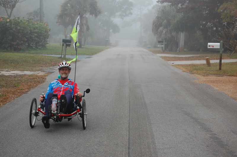
Ms. May took this on a very foggy morning, but considering the clothing I have on (it looks chilly), it was probably January ?
a cropped-image is here: small - (333 k bytes) large - (1.1 meg-a-bytes)
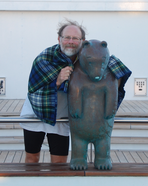
YUP! - that's ME and Mr. Pool Bear (by: Tom Otterness) on the cruise-ship "Infinity" ( Celebrity CruiseLines ) on a VERY CHILLY MORNING - more about the cruise in the February 2011 web-page...
Archived BeachWeb monthly (and other) site(s): Click here for a list of the archived months
updated: 16:34 p.m. (USA-PDT) on Sunday, 31 July, 2011; by: Mr._Bill on the Apple Macintosh
'AirBook' - revID: 1y


